- Batasari Travel Tales

- Feb 22, 2022
- 6 min read


Kudremukh Trek the Most beautiful trek in Karnataka.
It is in the center of Western ghats in Chikmagalur district, comes under Kudremukh National park which is UNESCO world heritage site. Kudremukh is the third highest peak of Karnataka at an altitude of 6207 feet and often people refer it as a second highest peak as well. Kudremukh means, Horse face in Kannada. Kudremukh peak resembles Horse face.


How to reach:
310 Kilometers from Bengaluru & 120 Kilometers from Mangalore.
The base village for Kudremukh trek is Mullodi Village which is close to Kalasa. There are no direct Buses to reach Mullodi.
Route:
Bengaluru - Hasan - Kalasa - Balagal - Mullodi (Base camp village)
Mangalore - Kaikamba - Mudbidri - Kerekatte Vanyajeevi Valaya - Balagal - Mullodi (Base camp village)
Note - Cars will not go beyond Balagal unless its a 4 wheel drive. Read through the Own transport section below.
By Bus -
Bengaluru to Horanadu bases goes via Kalasa. Both KSRTC & Private operators has buses in this route.
If you are traveling from Bengaluru, take over night Bus from Bengaluru and it takes around 6 to 7 hours to reach Kalasa.
From Mangalore, it takes approxmately around 3 to 3.5 hours to reach this place.
I have traveled by KSRTC Sarige class bus in the day time which took close to 10 hours to reach Kalasa from Bengaluru.
Refer KSRTC website for details on the timings: https://www.ksrtc.in
By Train -
Mangalore is the nearest railway station which is well connected with all major cities of India. From there, one need to catch a Bus or Taxi (120 Kilometers).
By Air -
Mangalore International airport is the nearest Airport for Kudremukh trek and from there, one need to catch a Bus or Taxi (120 Kilometers).
Own transportation -
Google maps route is accurate and below is the navigation route:
Beyond Balagal, Cars will not go as its off road drive (around 5 Kilometers) and only 4 wheel drive Jeeps are used to commute till Mullodi (Trek base camp). Park your vehicle at any shop or at the Home stay.
Check list:
Location | Western Ghats, Chikmagalur District, Karnataka, India |
Trek Distance | 18 Kilometers (Both ways) |
Altitude | 6207 ft. / 1892 Meters. |
Trek Duration | 7 to 8 hrs. (4 to 5 hrs. to accend & 3 hrs. to Descend) |
Season | June to Feb. Better views - Post Monsoon |
Trek Permission | Required to obtain from Forest office at basecamp in Mullodi |
Daily limit | First 50 |
Trek Fee | 575 / Head |
Trek Guide fee | 1000 / Group |
Jeep ride charges | 500 to 800 / group |
Trek Guide | Mandatory |
Water | Availble on trail |
Toilets | Not Available |
Food | Need to carry |
Trek Grade | Easy to Moderate |
Camping | Not Allowed |
Itinerary
Day 1 -
10 pm - Start from Bengaluru (over night journey)
Day 2 -
5 am - Reach Kalasa
6 am - Reach Pre-booked Homestay. Fresh up & breakfast. Pack lunch for noon.
7 am - Head Mullodi forest office. Jeep to be arranged by Home stay
8 am - Complete formatlities Forest office & start the trek
12 pm - Reach Summit & Finish Lunch
1 pm - Start Descend
4 pm - Reach forest office
5 pm - Reach Homestay & fresh up
8 pm - Dinner and pack things
9 pm - Reach Kalasa and take return bus to Bengaluru
Day 3 -
5 am - Reach Bengaluru
Things to Carry
Backpack - 20 to 30 liters
Rain coat / Poncho - Must during Monsoon
Trek shoe - Ankle covered
Trek poles - 1 or 2 (helpful during water stream cross)
2 Liters of water / Hydration pack
Quick dry T shirts / Trek pants
Energy Bars
Plastic Cover to wrap Mobile / wallets / Electronic gadgets (remember to bring it back)
Electrolite powder
My Trek Experience:
It took almost an year for me to execute the plans after hearing so much about this Trek.
Ever since the monsoon season started, i have been checking the weather forecast and almost rains were forecasted everyday. Later i found that, Kudremukh is one of the highest rainfall places in india.


One fine weekend in the month of August, i have started my Journey from Chennai.
Took Shatabdi express around 6 am in the Morning and reached Bengaluru CNT by 11 am.
My bus from Bengaluru to Kalasa is around 12.25 pm from Kempegowda Bus stand. i have had another round of breakfast near Bus terminus and KSRTC Sarige bus started around 2 pm.


It took almost 8 hours to reach Kalasa and i was there by 10 pm. As it was late, Auto or Buse's May not be available to go to Homestay which is at Balagal, Hence the Home stay i have booked (Bella Home stay) agreed to send Auto. It was around 11 pm when i reached Homestay. Finished dinner and checked into my Tent.


It rained throughout the night. I couldn't get enough sleep due trek excitement and it usually happens to me. Alarm ticked by 5 am and i was ready by 6 am. Breakfast served at 7 am and i took a walk around the place for some time. Met some of trekkers who finished before day and they have shared the experience.
Packed lunch was given and started from Home stay around 8 am and it took around 45 mins to reach Base camp Forest office in Mullodi. Probably the scariest offroad drive i have ever experienced so far. Our guide has joined us somewhere in the middle. At the entrance of forest office, there was a peacock spotted on near by tree.


Forest office entrance
Trek Permission, Guide fee & Jeep ride cost was part of the Homestay package. Watch the trek series videos on www.youtube.com/batasaritraveltales
Our trek guide completed the formalities and post bag checking, trek started around 9 am.


There are 3 sections in this Trek.
Section 1 - Forest office to Ontimara 2 (Lone tree 2)
Trek Distance - 5 Kilometers
Duration - 3 hrs.
Trail goes right behind the forest office and we get to hear the sound of a Somavathi waterfall after trekking about 10 minutes.
Combination of forest section, grass lands & multiple water streams makes this trek most beautiful in western ghats. Views of the misty mountains treat our eyes during monsoon.


Various Water stream crossings
Forest section of the trail is covered with trees multiple water streams as we move forward. Trail also ascends gradually. At the end of forest land, we reach Ontimara 1 which is a big tree.


Ontimara 1
From Ontimara one, it takes about one and half hour to reach Ontimara two which is end of section 1.


Trail is mostly flat and close to 8 water streams we cross till we reach this place. During Monsoon, some of the streams will have higher water flow which will wet our shoes.


Leach i have removed after coming to homestay
Leaches are quite high during monsoon. Apply Dettol liquid upto knees to avoid these, however it may not be effective during rain.
Also, carrying a rain coat/Poncho is a must.


Ontimara Two
Section 2 - Ontimara two to Final stretch till water stream
Trek Distance - 3 Kilometers
Duration - 1 to 1.5 hours
This section of the trek is difficult, as trail gets steep with in few mins walk from the Ontimara two. Trail will be slippery and need to watch out our steps.


Keeping ourself hydrated is very important and one may need to take multiple breaks during this section. When i started this segment, it was heavy rain and i could hardly see the trail.
Rain continued till i reached the final stretch which is close to summit.
There is a water stream and this is the final one hence i have refilled the bottles.
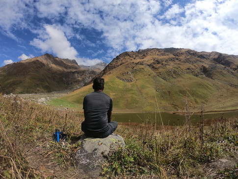
Kudremukh summit offers 270 degrees views and i know i could barely see the one walking infront of me due to rain. Waited there about 30 mins to see if rain stops but i wasn't lucky.


End of Section two. after crossing the one kilometer to sumiit board.
Section 3 - Final stretch to Summit
Distance - 0.5 Kilometer
Duration - 30 mins
It was aroud 12 pm when i reached the last segment of the trek and downpour continued.
By then, i have already made up my mind that i would not be able to have any views from the summit. Still i would want to give a try by waiting there for couple of mins and see if clouds gets cleared. As i was already par with the time, didn't have any concerns from my Trek guide.
Trek guides constantly remind their team about time to reach and summit and return. Some times, it iritates too.
After waiting for about 15 mins, i have started my Summit push. It's quite easy and down pour continued. Around 12.45 pm i have reached the summit.
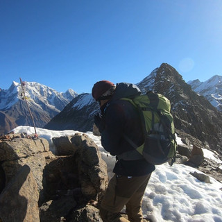
Rain spells were on and off and winds were heavy. Finished eating my lunch and completed Summit rituals (Photos & Videos).


Summit Moments
Remember, Forest department has time limitation for this trek. You must return back to Forest office before 6 PM. Instruction is that, where ever you are by 2 PM, must start to descend.
i have spent around 45 mins and started to descend. Remember, most of the accidents and injures during trek takes place only during descend hence one need to be very careful.


Views while descending
Best part of descend, we have views to the Kudremukh Valley till we reach Ontimara two.
Leaches, wet shoes & clothes, slippery trail will challenge you physically and mentally.


Beauty of Kudremukh Mountains
Reached forest office around 5 pm and waited for Jeep to come. There was a homestay near the forest office serves evening snacks and Tea. Our group spent time there over snacks while our shoes and clothes dried. That's the end of my trek!
Do reach me out through Comments section / Youtube / Instagram / Facebook if you still have any questions or feedback. Check the links below.
Watch the trek Vlogs on youtube:
https://youtu.be/NntQvFAdnCo
Batasari travel Tales - Enabling Travellers to plan their own Treks & Trips.